Go to https://www.gov.nl.ca/alerts/ for OFFICIAL alerts.
UNOFFICIAL Paddy’s Pond Fire Map ESRI Link
Paddy’s Pond fire has been controlled and evacuation ORDERS and alerts have been rescinded.
The ESRI link is deactivated
Updated as of 2025-08-17 12:00
How to use the above linked map
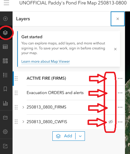
The link above will take you to our ESRI Paddy’s Pond fire map. When you get to the page you will have the ability to toggle the source images, the current alerts as found on gov NL’s page, and the active fire according to NASA FIRMS as the time indicated in the layer.
Click on “Layers” which looks like three square pancakes on the top left of the page. You will then be able to click as noted to see the relevant information. We will update as soon as we can.
Active Sources used in map
Below are three sources for imagery related to the fire with the primary source being NASA FIRMS.
https://firms.modaps.eosdis.nasa.gov/usfs/map/#d:24hrs;@-52.89,47.50,13.73z
https://cwfis.cfs.nrcan.gc.ca/interactive-map
https://fire.airnow.gov/#2.92/42.6/-50.5/20.2
These are the links to the pdf’s provided in the https://www.gov.nl.ca/alerts/ page. We are simply noting the sources here. Please go to the Provincial Government’s main page for the official alerts.
Evacuation ORDERS are rescinded
Evacuation Alerts are rescinded
Please reach out to us via info@streetsafp.ca for comments or feedback.
