
Metrobus Transit ALF (accessible low floor) Bus Stop Analysis
If you have feedback on these maps, please let us know on our Contacts page: https://streetsafp.ca/contact/

An often overlooked but critical aspect of Metrobus are the accessible low floor buses (ALF). Happy City approached us to see if we could help parse the unintuitive and confusing data on Metrobus’ website as it relates to these accessible routes. With only a text list of inaccessible stops and inaccurate route information, understanding the ALF routes is difficult.
This seemed like a worthwhile project that we could help with. We could generate a more intuitive map for users and generate interesting information for happy city to discuss the true accessibility for users, when you factor in snow clearing sidewalks and covered bus stops.
Metrobus was able to provide us with their GTFS (general transit feed specification) data which does not include full accessibility data by default. We were able to combine this GTFS data with our roads network database (coming Summer 2023) and the ALF text data on Metrobus’ website to generate specific information that Happy City was looking for. Below are the results of that project.
Click the images below to open the ArcGIS Maps in a new tab!
ALF Summary
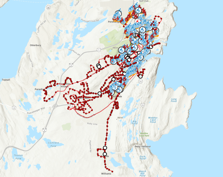
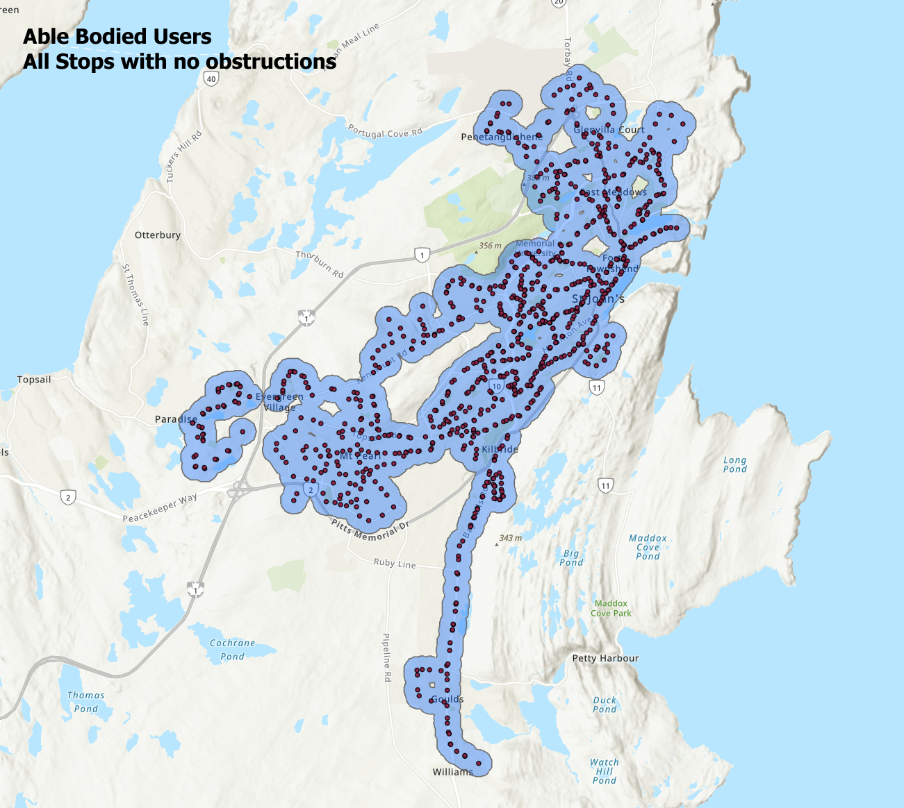
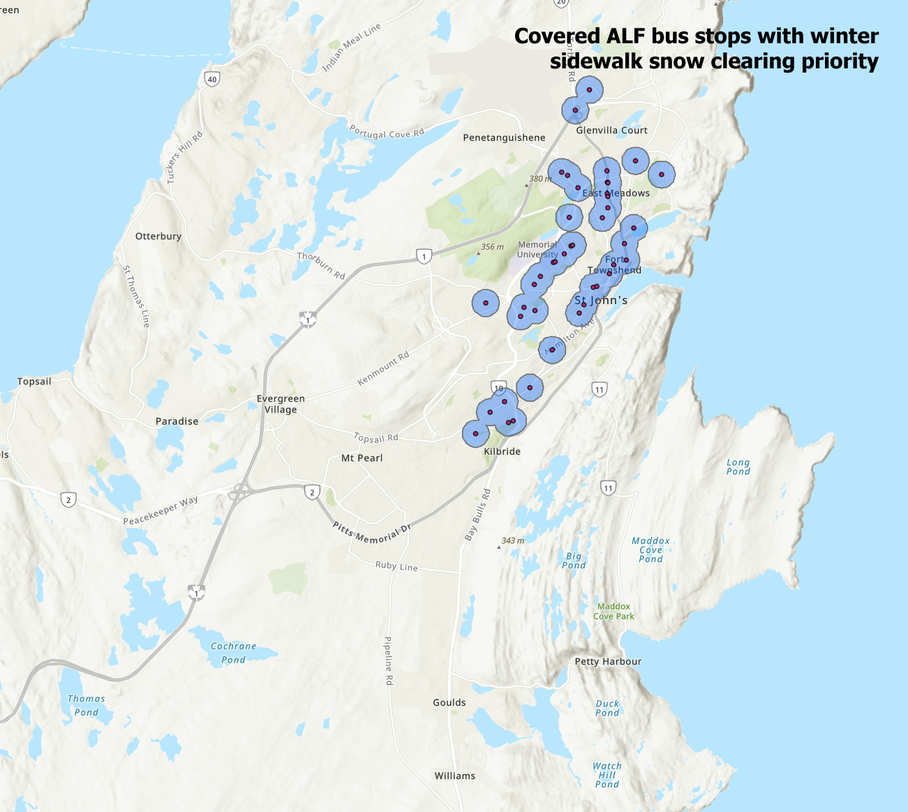
Bus Stop Service Comparison
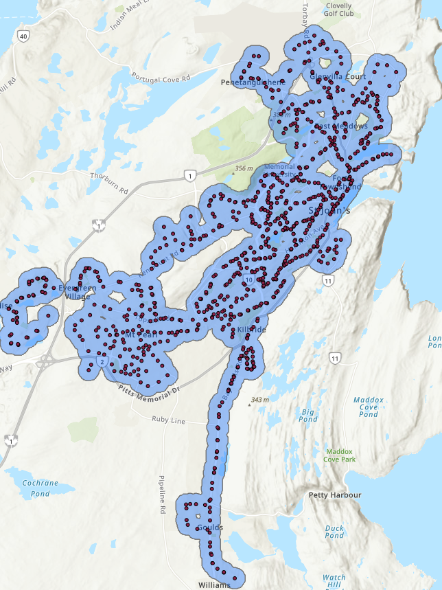
Below is a scroll-able preview of the ALF bus stop service comparison exhibit map
There are several sources of this data that we would like to note:
Metrobus Transit management and IT graciously provided us with their GTFS standard transit system data. This made it relatively easy to import route and stop data, timetables, and much more.
This data did not include ALF route data, so that came from the following pages:
https://www.metrobus.com/alf/schedules.asp
https://www.metrobus.com/alf/handbook.asp#inaccessible
https://www.metrobus.com/alf/handbook.asp#stops
The City of St. John’s provided us with some GIS data from their LIS department. This included their online map centre core Representational State Transfer (REST) service data for sidewalk clearing priority, geospatially accurate 5cm/px aerial mapping for links and routes not accurately tracked by Metrobus, and some other useful elements.
https://map.stjohns.ca/mapcentre/#
https://map.stjohns.ca/sidewalk/
Open Street Maps is the main source of our core road data. We heavily modify this data with additional information from local municipalities and the Department of Digital Government and Service NL in our major database as part of our major North East Avalon municipal infrastructure analysis database project (version 1.0 coming Fall 2023).
Happy City St. John’s reached out to us to help them with this project. We are humbled that we were invited to help with their first mapping / GIS project. More projects are potentially in the pipeline so expect to see more with this partnership. Working with other not-for-profits and community assisting organizations is one of the core concepts we strive to adhere to.
The team at Streets Are For People volunteered nearly 155 combined hours of work for just this project. A lot of work goes into curating this data, verifying it, generating the graphics, running the website and more. We hope these maps provide a service to the community. We are not finished updating these maps. As we receive feedback, and update other sources of data, expect to see more from us.
