Before we blow your minds with graph-filled, optic nerve stimulating, carefully hand-crafted data about what sprawl does to our municipalities, let’s first bask in their everlasting glory.

Now, several of us at Streets are for People live in the suburbs so I just want to mention that this post is simply some interesting visuals to look at and to have a laugh. There is nothing wrong with wanting to live in the suburbs or enjoying it. The problems we will talk about later are strictly about the financial structure and maintenance issues of suburban and exurban development. The city should know the issues, yet they continue to send us into a maintenance nightmare with even more water mains breaking, even more potholes, and worsening services.
Are you not entertained?
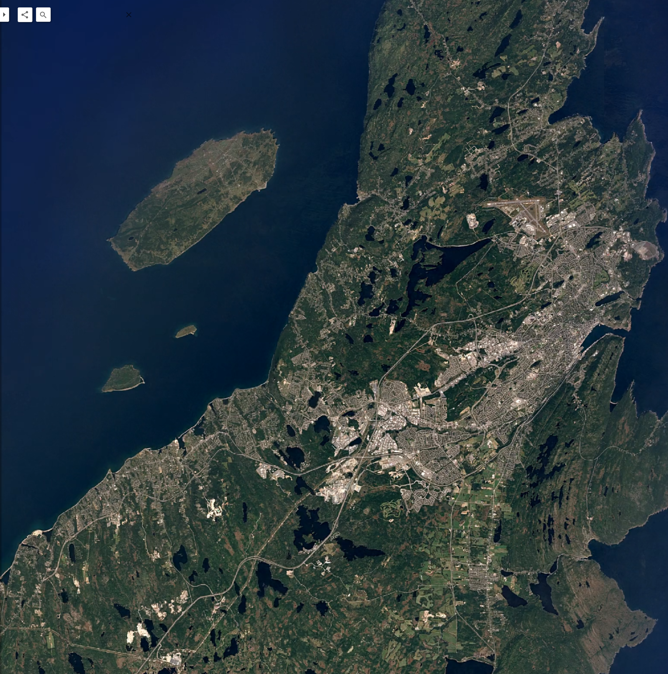
With that out of the way, let’s start our little tour. There are three image slider comparisons below, which represent a large jump in time for the North-East Avalon region. It starts with the poster child of sprawl: Mount Pearl and everything around it. This beautiful area is home to over 60,000 people and is essentially a donut (assuming the donut’s dough is 90% single detached homes and has a delicious jelly filling of one-floor industrial/commercial low-density box buildings). The image below (Image 1) is a comparison between 1985 and 2025. Four whole decades apart.


Well, maybe that was just a little too close. We could see the nose hairs of some of those houses. Let’s look at the wide shot from the elevation of about where NordSpace’s first rocket will peak at (or has already peaked at): 40 km (Image 2). We can now see all the glory of 4 new bypass highways that have been built, and the city-crossing Team Gushue highway. Can you name all 4 bypass highways built since 1985? Please send me your answers on social media 😄
What we see is a focus on spreading the city out as far as it can go into the woodlands of yester-year. During this time frame, there was essentially a 30-year period during which we stopped building apartment buildings. Crosbie , Torbay , Elizabeth towers, Penny Crescent, Pearlgate, Freshwater, and many more are all approaching 50 years old now. From the late 70’s until the late 2000’s, pretty much all that was built were the apartments on L’anse Aux Meadows. There was then a start up with McGees Grove and Place Bonaventure. Since then we’ve gotten Tiffany and Kennys senior homes, the buildings out in Pleasantville, MIX, and Star of the Sea. However the amount of construction back in the 60’s and 70’s that was high density was very large relative to how many single detached homes were built. It is truly staggering. Now apartments buildings and even townhouses are are a small fraction of what we build. Dammit… I got preachy and started talking history 😅.
Again, these are just kind of fun to look at. You can generally hold ctrl+scroll you mouse wheel to ‘zoom in’ the image. Success may vary. This image is also 1985 to 2025.

Something you might not have noticed is that the core of St. John’s hasn’t really changed. Like at all. Since like 1890. Other than the fact that St. John’s tore up all our street cars, wrecked our public buses, removed two different rail lines, and obliterated like 10% of downtown to build a massive highway, it is basically the same as 1890, plus all our new technology. Oh yeah, and there are so many roads for cars–things that didn’t exist at the same level as in 1945ish, when this next comparison image was taken (Image 3).
I tell you what though, that military base is absolutely boppin! It was such a dense development in today’s standards with dozens of multi-floor barracks/apartments. ‘Weren’t they filled with asbestos and lead paint and did they dump hundreds of thousand of litres of oil into the ground?’ Stop asking questions and enjoy the images!
This image is around 1945 to 2025. That is a full 80 years! Though the 2025 image is greyish, that was done on purpose to make the B&W aerial image match better.


Well that is it I guess. This was a simple post to fill you with some interesting imagery to ponder whilst you put off that task you are supposed to be doing. It is wild to see how much of the city sprawled out from the dense downtown core once the 1940’s hit. Our current car filled downtown used to be a load of lively busy streets for people (and horses).
