We’ve wrote a lot about housing affordability, road safety, infrastructure, history, and much more here in St. John’s metro. One of the ‘more’ items is Metrobus. We try to be impartial but ultimately, transit is a public service, which means it is political. We have heard from many residents regarding their issues and it has led to us analyzing transit delays, accessibility, route structure/connections, and more. Our findings often leave readers with a sour taste for Metrobus, though this is not our goal. Our goal is to highlight issues, and hopefully educate the public in what can change.
One of the things that we have seen is a lack of physical wayfinding maps in St. John’s. Digital wayfinding is fine, but it becomes a barrier for folks who do not want to access mapping digitally. I don’t want to beat a dead horse so I’ll reference a Strong Towns post about Wayfinding if you are interested in reading some more. The one-sentence summary is that wayfinding simply refers to maps that allow a user to geographically understand where they are in a system, and where they can go from where they are.
Could we make wayfinding maps?
Short answer: Yes
Long answer: We won’t do that to you.
Medium answer: Could we have made individual maps in some graphics editing software? Sure, but anyone can do that. We wanted to make this dynamic and integrate our favorite thing: geo-spatial databases.
So because we don’t like to half ass things, we ended up adding a whole series of codes to our infrastructure database which fully disassembles metrobus route segments into coded pieces with direction and route information. This is more in depth than GTFS data gets from a graphical standpoint. What that allowed us to do is dynamically create a wayfinding map for ANY stop in St. John’s in minutes. Literally any stop. Was it necessary? No. Did it take a lot of time? Yes. Is it worth it? Well that is what this post is about.
We then surveyed 20 advocate transit users and asked them what stops they think should get a wayfinding map. The caveat was no Avalon Mall, Village Mall, or the UC, as it gets technical. Their choices were Stop #1245 Crosbie Road South and #1525 Torbay Road Mall South. So we had a goal, a location, and a task.
Metrobus Wayfinding – by Streets are for People
Once we figured out a workflow to bring the maps from ArcGIS into a final product worthy of printing, these were our results.
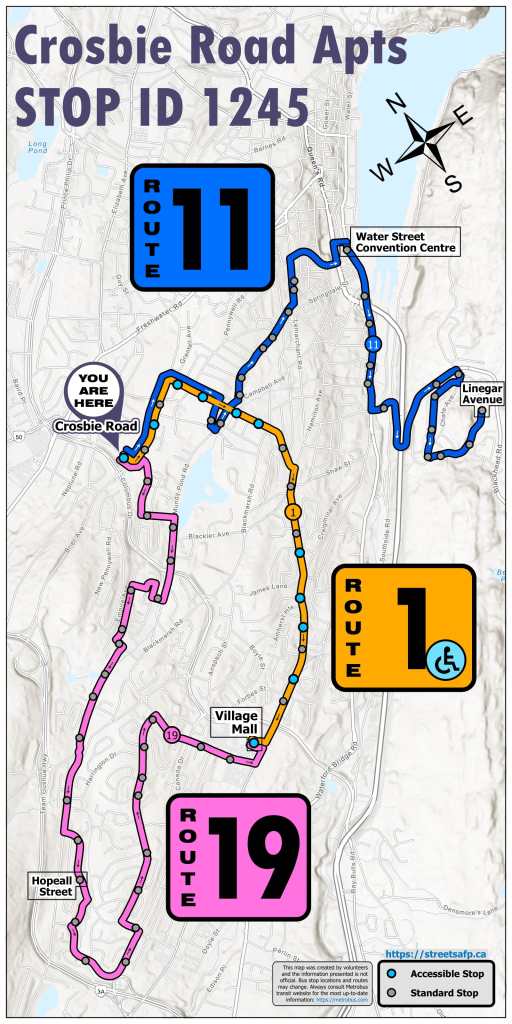
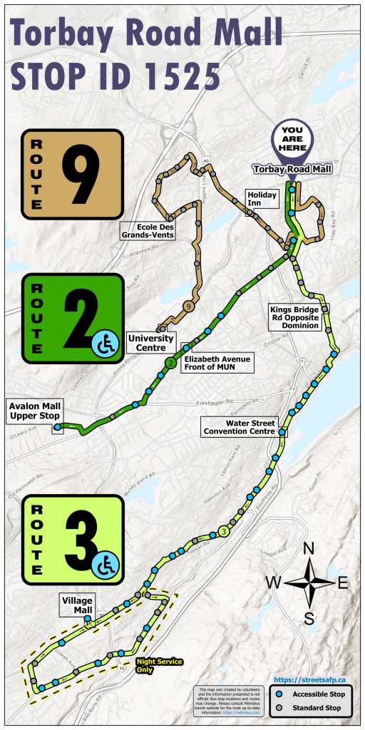
Our goal was to make something visually easy to read, but geospatially accurate. We wanted the maps to be the same size and roughly same scale. We aimed to use the general color scheme to be mostly uniform across our projects but also not look out of place at a Metrobus Stop. We feel like we succeeded in our goal. That said, we’d love to hear what you think of these. You can always leave feedback on our website.
Map made. Time for feedback
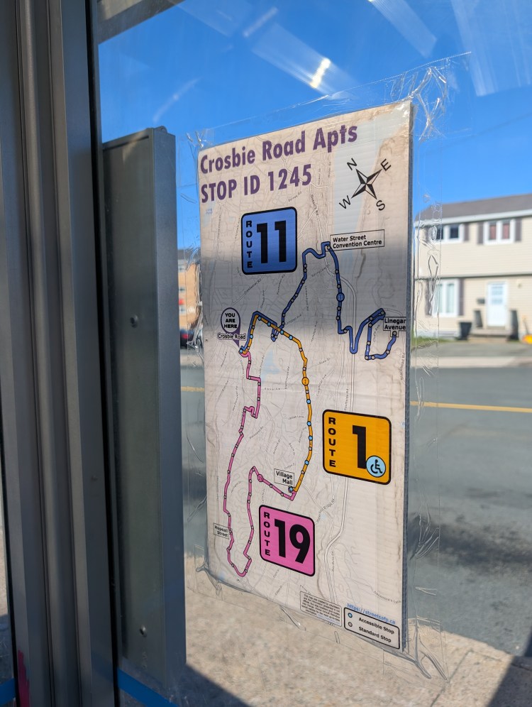
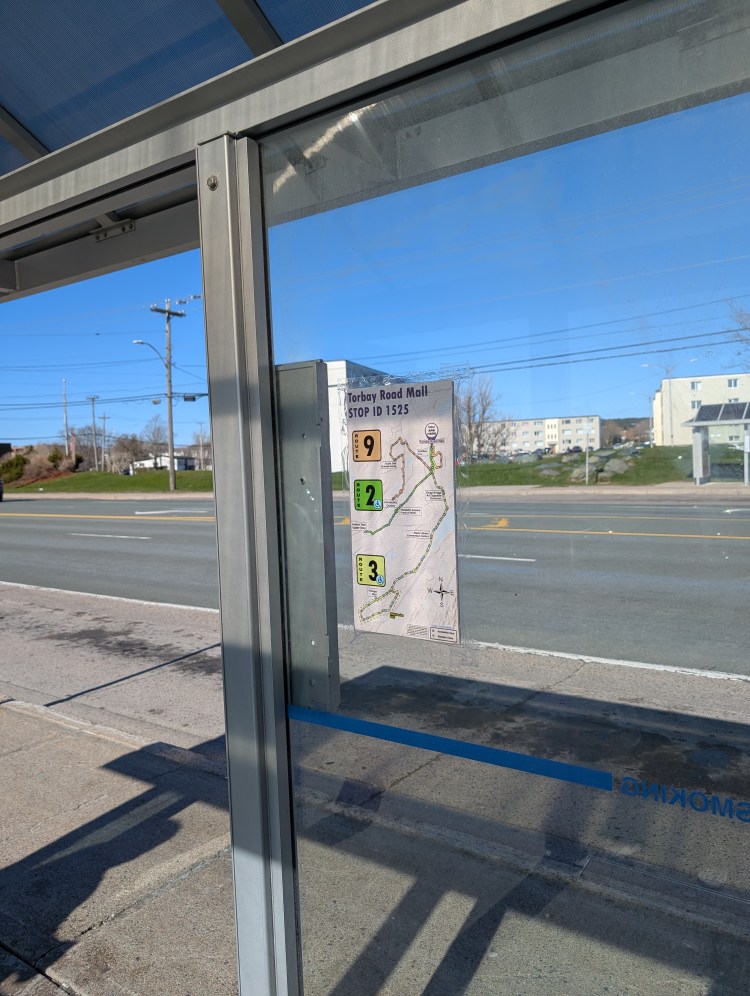
So with maps completed, we got them professionally plotted and made weatherproof. We went out to the two stops and stuck them up. We originally made them to be zip tied to poles, but it ended up being easier to stick them to the glass interior. We cleaned the glass and stuck the signs up. I went back to the stops and asked a few patrons their thoughts and the feedback was great. Everyone I spoke to loved the wayfinding maps and had no issues understanding the data shown.
Mission accomplished… wait
So we figured these signs would get removed eventually. Though we are trying to do a public service, Metrobus likely has a policy to not advertise or stick anything on their stops, but it isn’t obvious on their website so we cannot cite a source. It would be a pretty good policy as no-one wants their bus stop to become a billboard; just ignore the paid advertising. However we didn’t expect the staff to be as quick. Within Streets are for People, we guessed that the signs would last maybe a month or two.
The total duration was less than 4 days. In less than 4 days, the signs were removed. We cannot fault the staff, but also we heard nothing from them of whey they were removed. We were not contacted via any method. To be clear, these are not advertisements; these are (were) wayfinding maps with a small link to our website for feedback. We feel that the overall concept was good and that this is something Metrobus desperately needs. We have reached out to Metrobus (2025-06-16) for comment, but have not yet heard back.
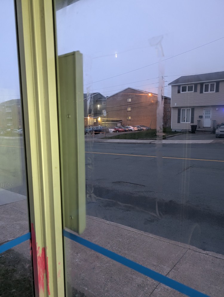
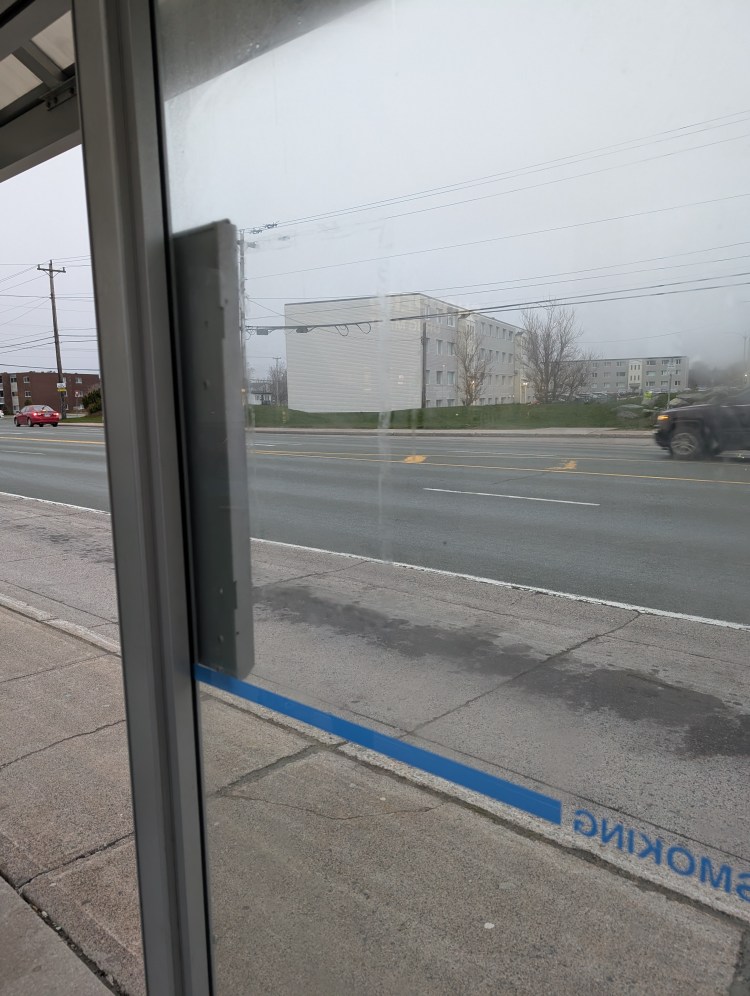
The dreary weather was certainly fitting for the photos.
Lessons?
While we understand that these signs may have violated some rule within Metrobus documents (we are not aware of it), we feel like they should have contacted us at least to tell us the reason for the signs removal. We would love to work with Metrobus to help make the system better, so we shall wait and see. Ultimately for us to have streets for people, we need a solid transit service.
