This is a simple post: Below is a comparison from an aerial composite plate of St. John’s in 1948 to modern aerial imagery from 2024. We can use several tools to warp and bend an image to align it to our current cm accurate modern aerial imagery. Without getting overly technical, aligning the images involves picking a common well defined point on the original image, and matching those to the modern cm accurate imagery. This is done every 200-500m. The software then uses some fancy math to warp the image to match those points, without making it look to distorted. The ‘warping’ can be tailored by adding/removing more anchor points, or selecting different mathematical transformation methods.
Below is just a simple image compare tool, and not an online ESRI map. Though we have several maps currently transformed, hosting them online comes with some issues. Several full images have copyright restrictions. Additionally, hosting images is more data intensive which means a much higher hosting cost for us. That said, there are opportunities for future collaborations. E-mail info@streetsafp.ca for more information.

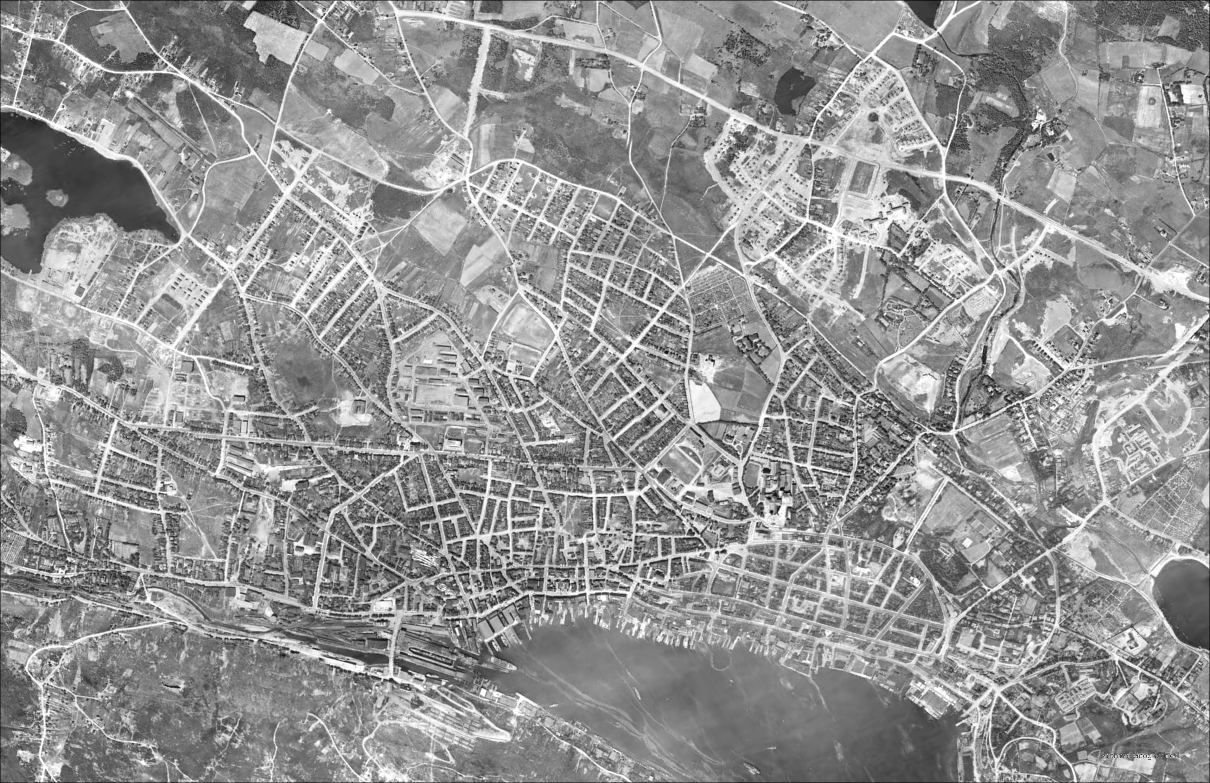
The 1948 map is made of dozens of individual photos that were manually stitched together without the aid of computers. This results in some abnormalities like misaligned roads that are hard to work around, but I did the best I could. The images were taken essentially when our streetcars were removed, which was when the City started the process of ensuring the streets were for cars, and no longer for people.

One thought on “St. John’s downtown: 1948 to 2024”