Zoning land use maps. They are the crown jewel of urban planning. What most people don’t know is that in North America, that jewel is often a blood diamond. That is a pretty harsh opening, I know. Allow me to explain via a ‘quick’ history lesson.
History of zoning
In the days of old, from about the dawn of mankind up until the the 19th century (so about all of human history) there was no zoning as it is today in North America. What used to happen is people would go to a place and build whatever was needed. That might be a store to sell your family farm goods, a house for some new dock workers, or a butcher to process some livestock. So long as you didn’t directly destroy someones things, or the community agreed whatever was being built was needed, all was good. Sometimes towns became a burden and they were abandoned, sometimes they would grow and leave the ancient husks of thousand year old towns buried beneath many meters of modern city for the time. Either way, towns evolved and adapted with the times.
Then WW2 happened. After that, the world came out of the largest production of stuff in history (weapons) and needed to rapidly transition from scores of tanks, ships, airplanes, rifles, mortars etc into literally anything else to keep ol’ mama-economy going. So rapid vast housing initiatives, large personal cars, and highways were chosen.
Before the 19th century, there were some zoning plans for a couple hundred years all over the world: London, New York, Tokyo, Paris etc. Most of these were hierarchical zoning. That is, things higher up on the order could be built anywhere, but things lower were restricted. This allowed people to build housing anywhere, but a steel smelter could only go next to a wharf down by a shipyard and not say, by a school.
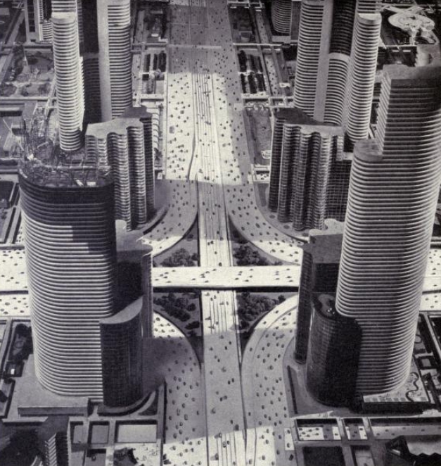
Then that devolved. Zoning shifted from hierarchical to what is called exclusionary. Planners thought they knew best and that restricting cities would allow them to build the ‘city of the future’ – brought to you by General Motors©®℗™ and Ford Motor Company©®℗™. These ‘planners’ thought that removing the organic nature of town development, ingrained in human nature for literally millennia, was not good enough. It needed the strict hand of guidelines to force it as they saw fit. With this new fangled car, anyone could travel anywhere without limit.
That is the very glossed over and biased view of the history hierarchical vs exclusionary zoning.
In reality zoning reform and planning allowed governments to plow highways through minority communities, prevent people of colour in obtaining mortgages (red-lining), and ensure literal race was a factor in who could even rent a house. The sad truth is segregation, direct government racism via red-lining, and many more factors came into play to give us the exclusionary zoning we have today. It wasn’t all to ‘protect home buyers’. It was a lot of racism. Like a LOT. However there are far better qualified groups and journalists talk about the social ramifications of urban planning.
History over – onto more history, just for St. John’s?
Here is what happened in St. John’s Metro. In 1946, St. John’s enacted an urban plan. The current plan is very similar to this 80ish year old plan, in the core. What it did was got rid of the loose and hierarchical community and merchant class zoning we had, where anyone could build whatever made ‘sense’ and restricted all types of development to certain locations. This took the community away from planning, and put it in the hands of a few. Maybe placing a factory next to a house is a bad idea, but that can be addressed without exclusionary zoning.

This map is just fascinating. You can read a great article on CBC here, but there are a few zoning specific items I would like to note.
First off, commercial morphed into mixed use as on this plan. That is because there was hierarchical use in the area where shops and houses just mixed, and the planners just wanted to ‘match’ the use case but hone it to their whims of commerce. That should have raised an alarm bell that people don’t want commercial only exclusionary zoning.
Second, note that the more dense residential was right next to industrial. Those houses were not for the ‘upper classes’. The biases of the British Empire to shove people right next to the factories shines bright there. Those factories didn’t really ever exist, but the plan was for them to exist. The industrial areas ended up turning into commercial low density in the end because St. John’s was never going to be an industrial powerhouse.
Next is look at the early vast expanses of green space. This more or less holds true to today. There are some exceptions, like how just east of the Avalon Mall is now a ‘highway’ (Prince Phillip Drive) and houses, but for the most part the planners wanted to ensure green space was created and maintained. For that I’d commend them. Planned parks area great, whereas the modern ‘green-space’ allotments in subdivisions leads to small bland grass lots with a swing set in them.
Only other thing to note is how the plan just ends. All the other land was just not important to the city. They either didn’t care, or didn’t anticipate the post WW2 boom that was coming. The land had some cabins, small communities, the rich estates of Lords/Lady’s of the Empire, wide expanses of farmland, or just forest. Regardless, there was no master plan. There was a goal to control what was ‘in the city’ but nothing more. But that wouldn’t last… not even for 5 years. The plan was amended many many times over. I’m sure some record exists down at the Memorial University Library, but that is beyond the scope of Streets are for People.
Onward to today. Get outta here history!
So nearly 80 years have passed since that zoning plan you saw above. The tiny British Colony capital city that existed back then now has more than 20 times the population and far more than 100 times the size (metro St. John’s). St. John’s, like most North American major municipalities had a population boom and with it, double digit growth for two decades, and nowhere to put that population.
So the City did what all cities did. They amended their plans to convert farmland to residential homes. They told the farmers they would get rich selling the land. This was true. They told the families that their homes would be the centres of new communities. They were. They expanded the services of the city outward, but not upward. All of this was regulated by strict exclusionary zoning. The former farm could never be farm again, as it had to be houses, schools and stores. But those stores could only go exactly where the planners said, because they knew best. The 70’s saw St. Johns’ grow and grow. We will have a timelines post and mapping in 2024.

Exclusionary zoning kept on being updated, with changes coming and going. Areas reserved for farming became housing. Areas with housing became commercial. Areas of commercial sometimes died out. What was clear is that zoning was evolving, but at the whims of planners, and not the communities itself. Ever wonder why there are not stores in the suburbs? Zoning. It isn’t what we chose. It is what we were told.
There have been some development schemes to promote more dense, walk-able, mixed use neighbourhoods but not much has come to fruition because the city still makes development of anything other than a single detached home vastly more complicated than it needs to be. Those schemes are for Galway and parts of Kenmount Terrace and Kenmount Hill. What should be a system where the developer can optimize the layout to increase density and make smaller calmer roads, ends up having wide fast roads and houses set so far apart that you could fir an Airbus A220 between them. Even though the city claims they are allowing development schemes, nothing is different. Nothing changed.
Earlier we showed the 1946 zoning plan. Back then half of the development scheme was for Residential 2 and 3. This is essentially what R2 and R3 are today. Set-backs on houses were small, lots were small, cars weren’t the centrepiece, and row house and plex units were not just permitted, they were the norm. It led to some of the most dense and high value land in the city. More importantly, it was over half of all the allotted residential development. High value, amenity rich areas for the regular middle class person. Then came the sea of R1 single detached housing. The Nuclear family dream.

One would assume that a roughly 50/50 ratio of townhouse/plex to single detached would be expected. It is after-all, a free market and townhouse/plex units are more affordable and sell faster so they are far better for first time buyers small families, seniors downsizing etc. Also, the original city was built that way and St. John’s was growing. So why not keep that excellent track record going? However that is not the case. The overwhelming majority, or 80% of all dwelling units on the North East Avalon are Single Detached.

You’ll see that the bedroom suburbs of Paradise, CBS, PCSP, Torbay are mostly single detached homes. Mount Pearl fares a little better with about 20% of the housing stock made up of large apartments, row houses, semi-detached houses, and townhouses. However St. John’s is nearly 31% NOT single detached homes. Removing St. John’s makes the urban fabric nearly 90% single detached homes. Also, the majority of St. John’s smaller denser homes are all in the old core that more or less existed in 1946.
Note that a single detached home is represented by not just ‘Single-detached house’ but also ‘Apartment on flat in duplex’. Apartments of that type are still in a single detached home. That makes a single detached home contain two dwelling units which is not the worst, it is just still pretty space inefficient and doesn’t make the City more tax revenue for providing services. A 200m2 home that is all one family or a 130m2 70m2 apartment don’t have a significantly different house value from the City’s perspective. Makes your personal mortgage better in the eyes of the bank, but that is a post for another time.
Where do we go from here?
Go back to traditional hierarchical zoning. Simplify zoning, remove discretionary uses, set up better rules. Just do something… anything.
St. John’s contains 56 different zones. There are 23 zones just for residential and apartment units. 23 specific zones because the city wants to control exactly how it is built without much thought in how to service that. Ignore that mixed use and dense areas make the city the most revenue and have lower climate impacts. Ignore that suburbs make it difficult to provide adequate public transit. Ignore that some of the most walk-able amenity rich areas of the city are illegal to build with our current regulations.
The city doesn’t even realize that other than some exclusive R1 areas, like Kenmount Terrace, most R1 does not make enough in tax revenue to recover their replacement costs over the lifetime of the infrastructure. Wonder why our roads and pipes don’t get repaired quicker? Well that is a more complex issues dealing with increasing vehicle weight and climate change, but less revenue is certainly a major factor.
So how about those zones? Wanna read them all? No? Well too bad; Here they are anyway. Get ready to scroll 😆.
- Mini Home Park (MHP) Zone
- Pocket Neighbourhood (PN) Zone
- Residential 1 (R1) Zone
- Residential 2 (R2) Zone
- Residential 2 Cluster (R2C) Zone
- Residential 3 (R3) Zone
- Residential Battery (RB) Zone
- Residential Downtown (RD) Zone
- Residential Mixed (RM) Zone
- Residential Quidi Vidi (RQV) Zone
- Residential Reduced Lot (RRL) Zone
- Residential Special (RA) Zone
- Residential Special 1 (RA1) Zone
- Apartment 1 (A1) Zone
- Apartment 2 (A2) Zone
- Apartment 3 (A3) Zone
- Apartment Downtown (AD) Zone
- Apartment Harvey Road (AHR) Zone
- Apartment Special (AA) Zone
- Atlantic Place Parking Garage (APG) Zone
- Atlantic Place (AP) Zone
- Commercial Downtown (CD) Zone
- Commercial Downtown Mixed (CDM) Zone
- Commercial Downtown Mixed 2 (CDM2) Zone
- Commercial Highway (CH) Zone
- Commercial Kenmount (CK) Zone
- Commercial Local (CL) Zone
- Commercial Local – Downtown (CLD) Zone
- Commercial Mixed Use (CM) Zone
- Commercial Neighbourhood (CN) Zone
- Commercial Office (CO) Zone
- Commercial Office Hotel (COH) Zone
- Commercial Regional (CR) Zone
- Airport (AIR) Zone
- Industrial Commercial (IC) Zone
- Industrial General (IG) Zone
- Industrial Quidi Vidi (IQV) Zone
- Industrial Special (IS) Zone
- C.A. Pippy Park (CAPP) Zone
- Cemetery (CEM) Zone
- Institutional (INST) Zone
- Institutional Downtown (INST-DT) Zone
- Open Space (O) Zone
- Agriculture (AG) Zone
- Forestry (F) Zone
- Mineral Working (MW) Zone
- Rural (RUR) Zone
- Rural Residential (RR) Zone
- Rural Residential Infill (RRI) Zone
- Rural Village (RV) Zone
- Open Space Reserve (OR) Zone
- Watershed

- Comprehensive Development Area (CDA) Zone
- Planned Mixed Development (PMD) Zone
- Planned Mixed Development 1 (PMD1) Zone
- Planned Mixed Development 2 (PMD2) Zone
I have worked on dozens of development projects from conceptual to final QA-QC all over the North East Avalon over the last 15 years and in the conceptual phase, the first question is ‘what zone do we pick to optimize the development’. That shouldn’t be a question. The question should be ‘what can be build to maximize value for residents and turn a profit’. For the most part, single detached is all that can be built and that seriously limits our ability to address the housing crisis and produce value for the community, and the developer. It does not mean it is what the market wants. In fact the St. Johns New Housing Needs Assessment says the opposite. It says people want smaller more affordable homes and that we don’t build any. With simpler zoning, a developer might be able to double the dwelling units per area and build smaller market addressing units.
We could start my simplifying the zoning to only 10 or so zones, and apply proximity rules, height rules, and use rules to that. Whether we like it or not, the City and Government are clearly no longer building housing so we require developers to do that work. Not all developers are one-track minded, I can assure you. They aren’t building low density out of malice. They are doing it out of simplicity. If all they are allowed to build is single detached then they will. They aren’t going to fight the system and have a City staffer put them on the ‘shit list’ just to gain a couple units. This sets a very high burden for first-time home buyers, continuing the housing crisis. A developer shouldn’t have to worry that their investment in land for building an affordable apartment will be stopped because a zoning change takes too long and gets struck down by locals.
What would that look like?
A homeowner would be able to start a small commercial business on their residential land. A couple residents would be allowed to sell their string of R1 houses to put up an multi-plex building if they wanted. A commercial site would be allowed to put housing on their lot if they want in a mixed use manner. Developers could fit 50 to 100% more units into a single area, making the city more money, addressing the housing inventory issues we face, and make more money themselves (incentives).
We need to stop having planners tell us where they want us to build and bring it back to a more organic hierarchical zoning system. We can still have rules that ensure a factory doesn’t get built next to a seniors home, but those rules shouldn’t be so restrictive that our city stagnates and becomes unaffordable.
We need our zoning to be for people, not only planners, same as how our streets should be for people, not only cars.
